| fix_type | fix_mode | fix_info | flags | count | Fix_Description |
|---|---|---|---|---|---|
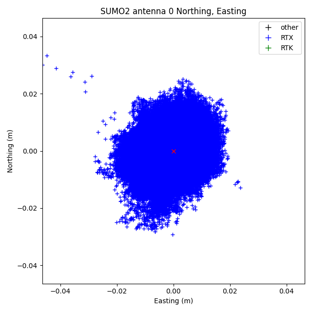
| 15 | 5 | 1 | 0x17:02x | 133199 | RTx; 3D solution; AM |
| 26 | 5 | 1 | 0x1:02x | 1 | GVBS; 3D solution; Unknown fix_type 26 to get fix_info. |
| antenna | w_mean_lat | w_mean_lon | w_mean_hgt | std_err | std_err_hprec | std_err_vprec | count | datum | datum_epoch |
|---|---|---|---|---|---|---|---|---|---|
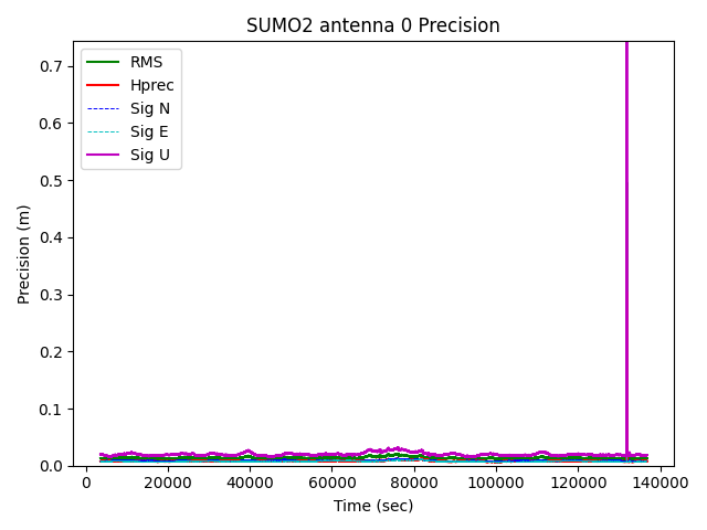
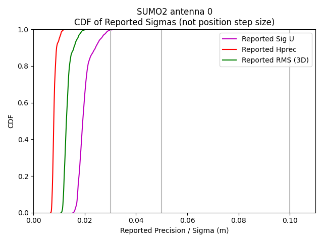
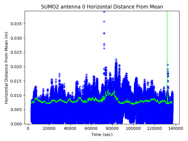
| 0 | 39.895516 | -105.113417 | 1645.386093 | 0.035685 | 0.008203 | 0.020207 | 133200 | ITRF2020 | 202632 |
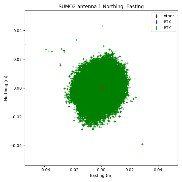
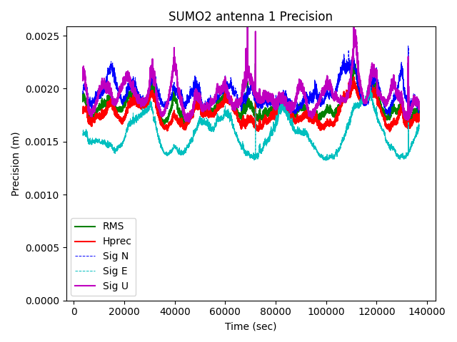
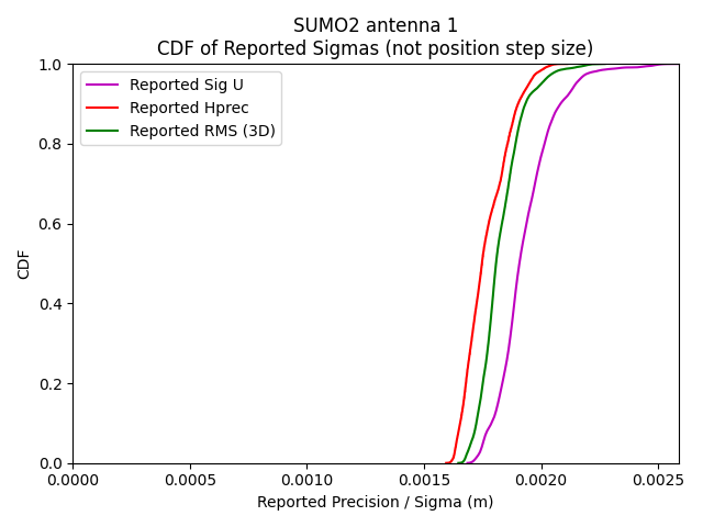
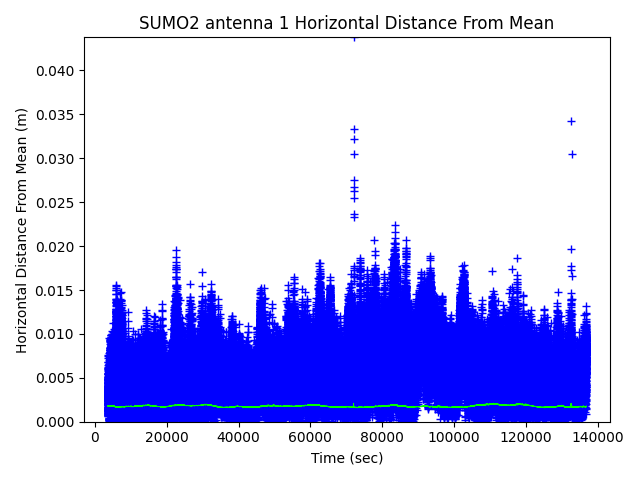
| 1 | 39.895527 | -105.113408 | 1644.970508 | 0.004984 | 0.001771 | 0.001936 | 133199 | ITRF2020 | 202632 |
| Total Time | Valid Time |
|---|---|
| 133199.0 | 133199.0 |
| fix_type | count |
|---|---|
| 15 | 133199 |
| 26 | 1 |
| Bit | Description |
|---|---|
| 0 | 1 if this is the master position (i.e. record 29 position) |
| 1 | 1 if the solution is a propagated solution (e.g. PM_FIX_20_HZ) |
| 3 | 1 if reference station is sending moving base CMRs. Only b0 and b1 of "rtkMode" are defined in Record 29, in the rtk block "mode" field. |
| 4 | rtkMode bit 0: 0=synchronized rtk solution; 1=low-latency rtk solution; |
| 5 | rtkMode bit 1: 0=no canopy detected; 1= canopy detected; |
| 6 | 1 if a baseline length constraint was used to form RTK vector. |
| 7 | 1 if a clock constraint was used to form RTK vector. |
| 8 | 1 if the RTK position is bridged |
| 9 | 1 if the OmniSTAR position is authenticated |
|
|
|
|
|
|
|
|
|
|
|
|
|
|
|
|
|
|
|
|
|
|
|
|
| SVType | Freq | count | mean | std | min | max | slips | slips_above_20 | dut |
|---|---|---|---|---|---|---|---|---|---|
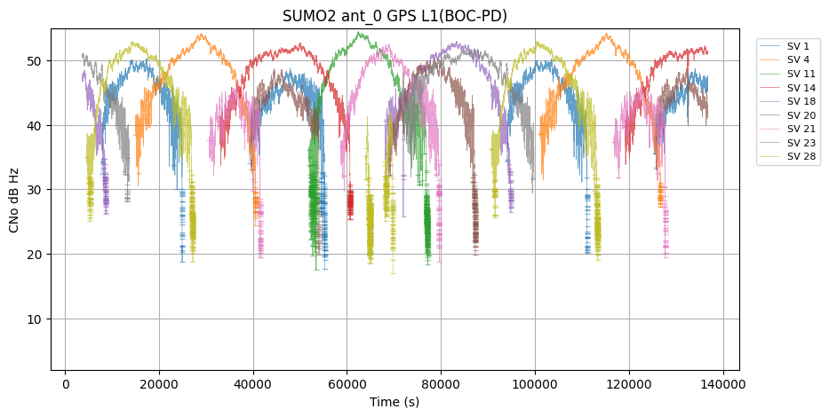
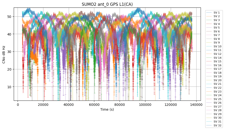
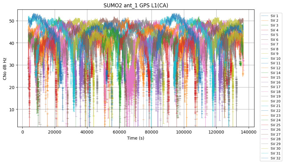
| GPS | L1 | 3561652 | 43.382538 | 5.531624 | 0.000000 | 55.400002 | 66633 | 11 | SUMO2 |
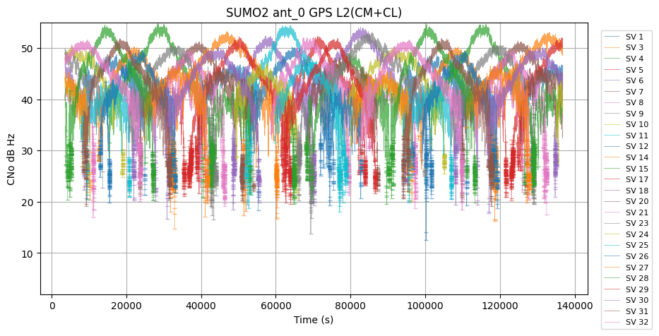
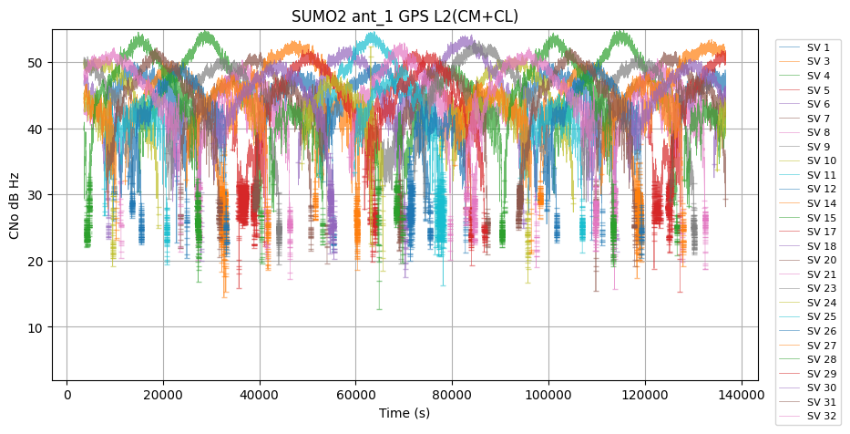
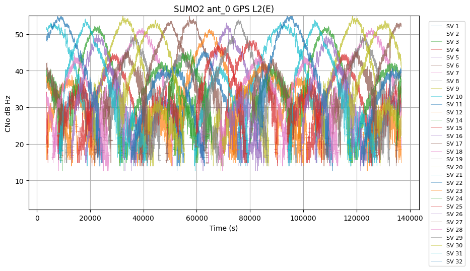
| GPS | L2 | 5062045 | 39.611328 | 8.418745 | 12.500000 | 55.299999 | 22884 | 1 | SUMO2 |
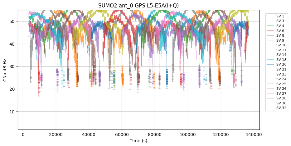
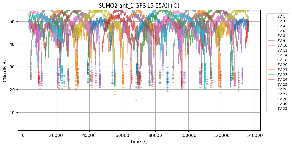
| GPS | L5-E5A | 1836527 | 48.453644 | 4.710774 | 15.200000 | 58.400002 | 5470 | 1 | SUMO2 |
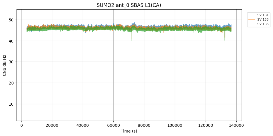
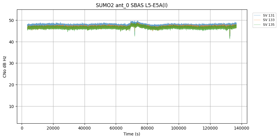
| SBAS | L1 | 399600 | 45.954762 | 0.591051 | 39.200001 | 48.799999 | 0 | 0 | SUMO2 |
| SBAS | L5-E5A | 399600 | 46.983078 | 0.611982 | 41.200001 | 49.799999 | 0 | 0 | SUMO2 |
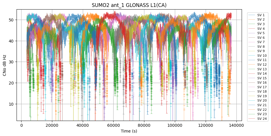
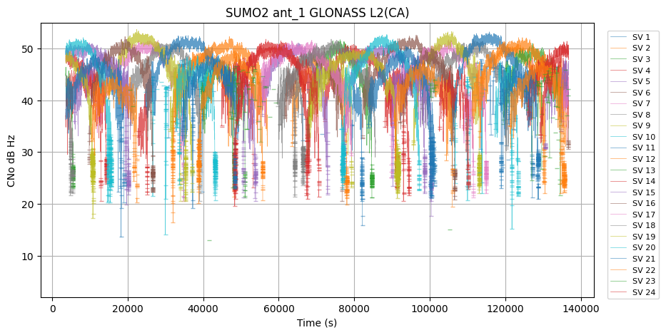
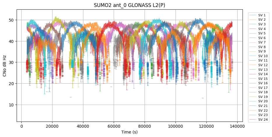
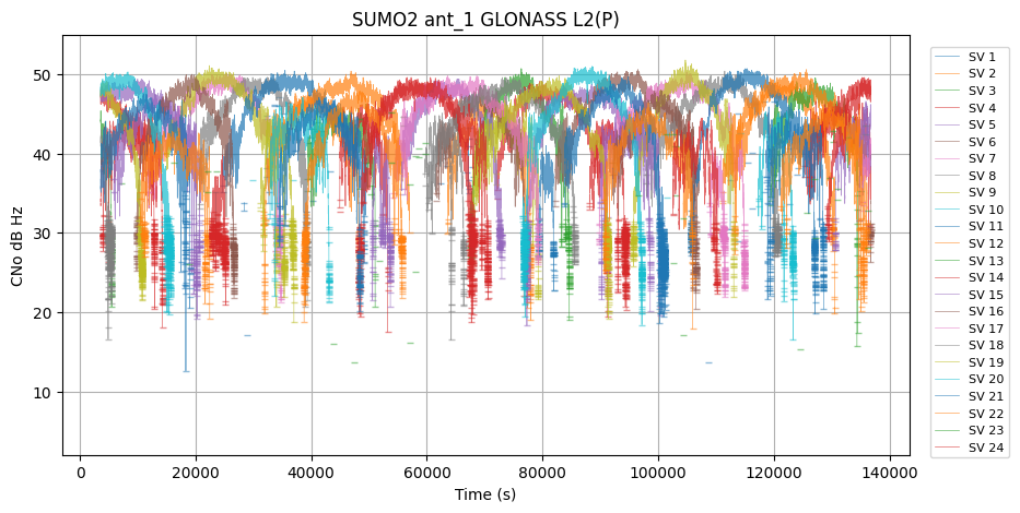
| GLONASS | L1 | 4350533 | 44.206032 | 5.185628 | 0.000000 | 54.700001 | 40788 | 18 | SUMO2 |
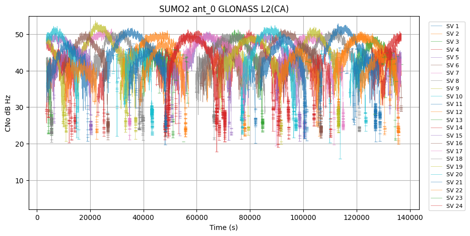
| GLONASS | L2 | 3567872 | 43.899853 | 4.455815 | 12.600000 | 53.700001 | 26195 | 997 | SUMO2 |
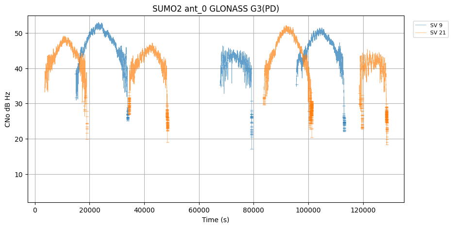
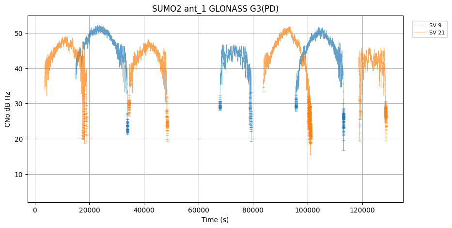
| GLONASS | G3 | 209377 | 44.225201 | 4.486562 | 15.500000 | 53.000000 | 1852 | 0 | SUMO2 |
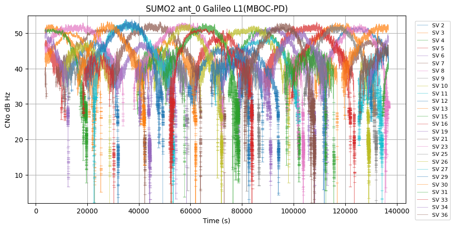
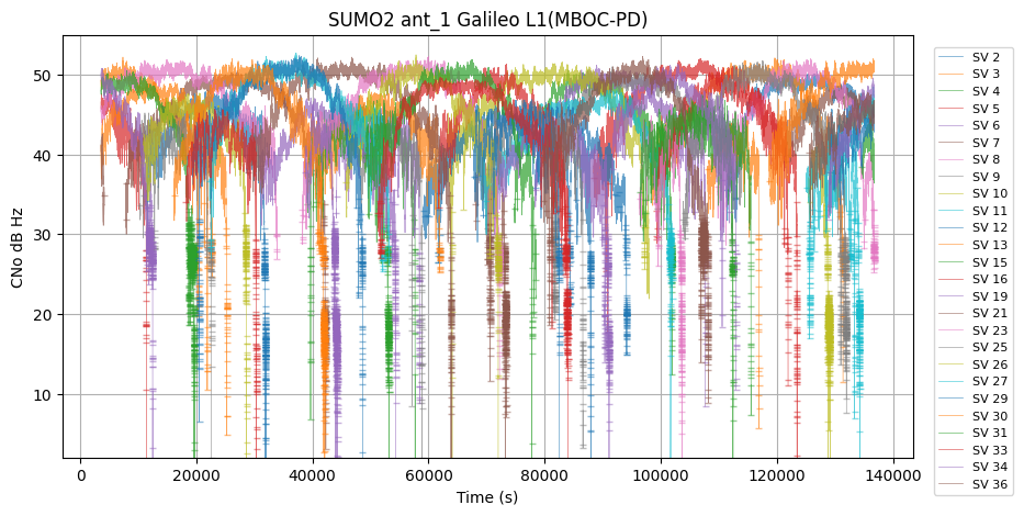
| Galileo | L1 | 2367122 | 44.305523 | 5.218998 | 0.000000 | 53.900002 | 20217 | 1 | SUMO2 |
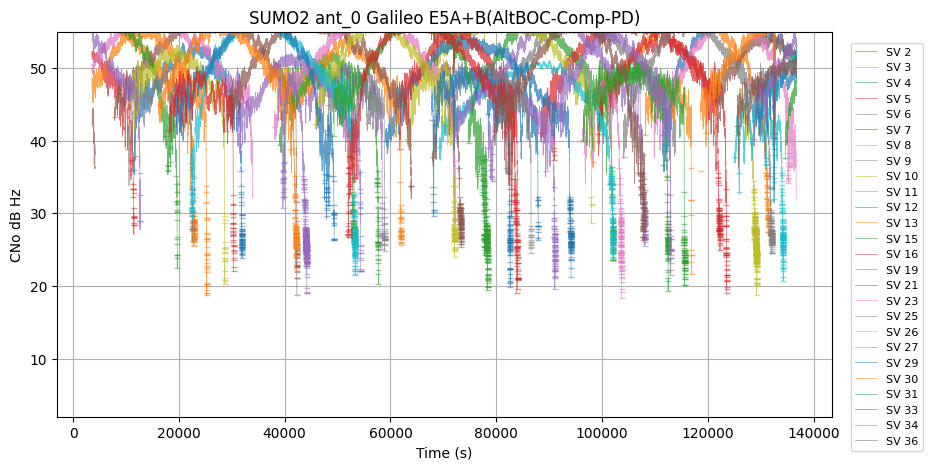
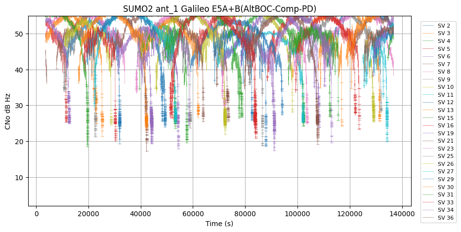
| Galileo | E5A+B | 2371762 | 50.214119 | 4.736984 | 17.200001 | 58.500000 | 6288 | 0 | SUMO2 |
| Galileo | E6 | 2317735 | 44.835114 | 5.444858 | 22.799999 | 54.099998 | 1006 | 0 | SUMO2 |
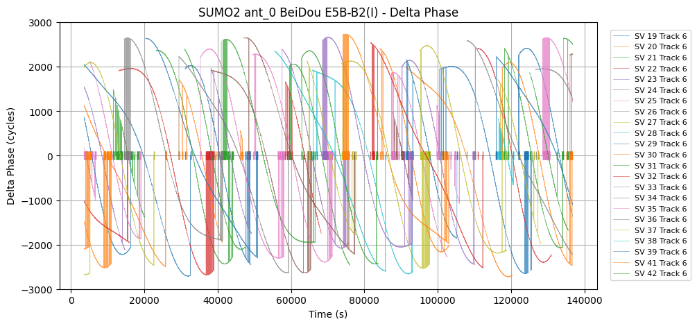
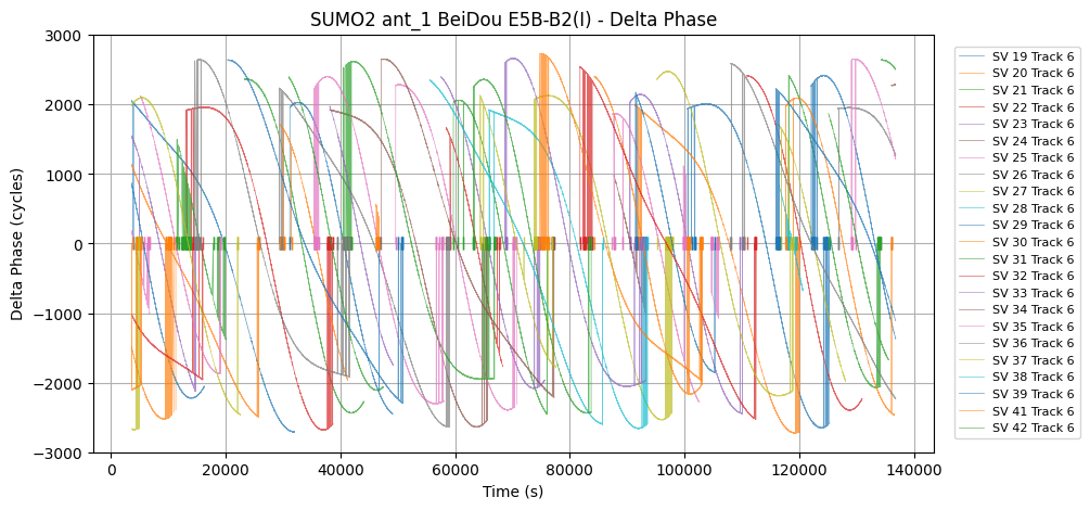
| Galileo | E5B-B2 | 2366163 | 46.820374 | 4.815435 | 17.200001 | 55.099998 | 8823 | 4 | SUMO2 |
| Galileo | L5-E5A | 2368988 | 46.145557 | 4.767481 | 1.000000 | 54.500000 | 9644 | 0 | SUMO2 |
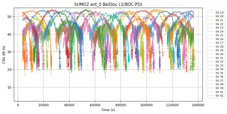
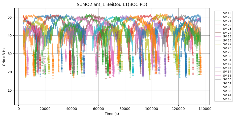
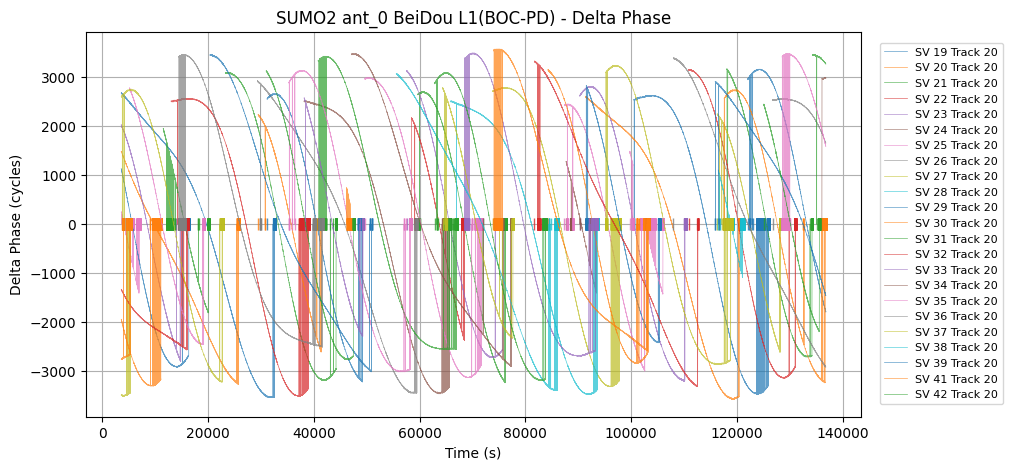
| BeiDou | L1 | 2078964 | 44.902653 | 5.381410 | 15.500000 | 54.400002 | 24868 | 5 | SUMO2 |
| BeiDou | B1 | 2545849 | 43.841049 | 5.674326 | 0.000000 | 54.200001 | 40067 | 1 | SUMO2 |
| BeiDou | B3 | 2520549 | 44.852234 | 4.863414 | 17.400000 | 53.400002 | 2390 | 1 | SUMO2 |
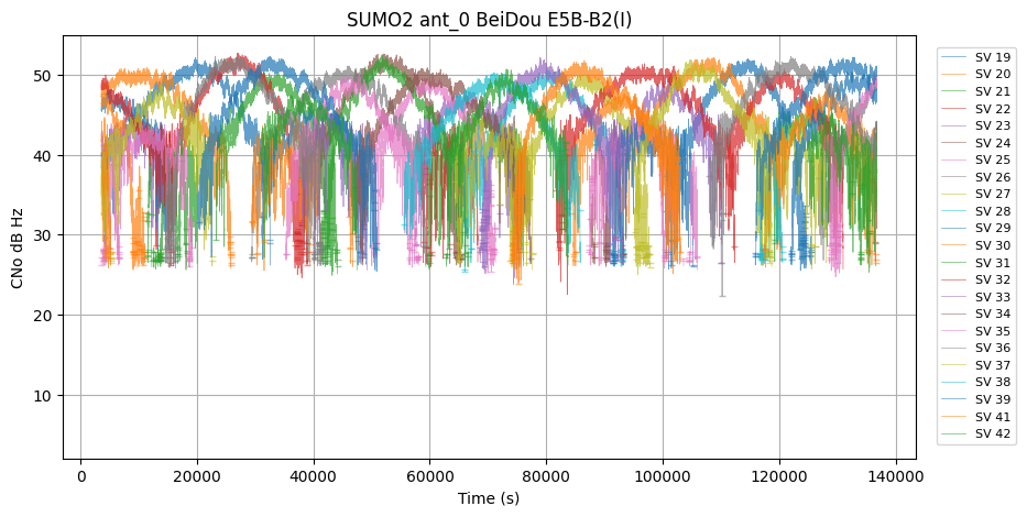
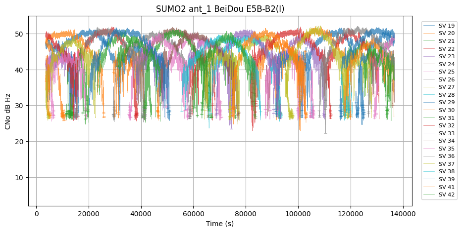
| BeiDou | E5B-B2 | 2023084 | 44.173435 | 4.976383 | 22.200001 | 52.700001 | 2020 | 1 | SUMO2 |
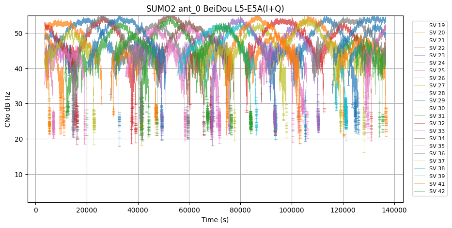
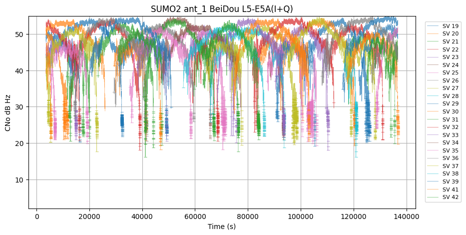
| BeiDou | L5-E5A | 2079407 | 46.928486 | 4.867761 | 16.200001 | 55.799999 | 9572 | 1 | SUMO2 |
-B1_snr_vs_time.png)
|
-B1_snr_vs_time.png)
|
-B3_snr_vs_time.png)
|
-B3_snr_vs_time.png)
|
|
|
|
|
|
|
|
|

|
|
|
|
|
|
|
|
|

|
|
|
|
|
|

|
|
|
|
|
-PD_snr_vs_time.png)
|
-PD_snr_vs_time.png)
|
-D_snr_vs_time.png)
|
-D_snr_vs_time.png)
|
|
|
-PD_snr_vs_time.png)
|
-PD_snr_vs_time.png)
|
|
|
|
-B1_delta_phase_vs_time.png)
|
-B1_delta_phase_vs_time.png)
|
-B3_delta_phase_vs_time.png)
|
-B3_delta_phase_vs_time.png)
|
|
|
|

|
|
|
|
|
|
|
|
|
|
|
|
|
|
|
|
|
|
|
|
|
|
|
|
|
-PD_delta_phase_vs_time.png)
|
-PD_delta_phase_vs_time.png)
|
-D_delta_phase_vs_time.png)
|
-D_delta_phase_vs_time.png)
|

|
|
-PD_delta_phase_vs_time.png)
|
-PD_delta_phase_vs_time.png)
|
|
|

|
|
|
|
|
|
|
|
|
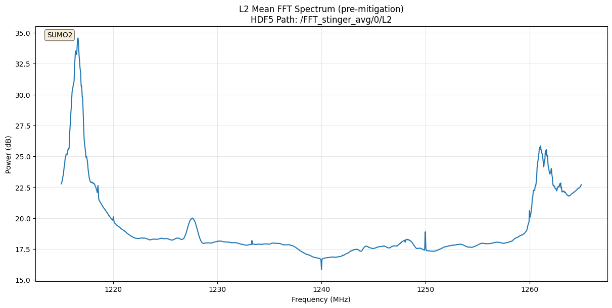
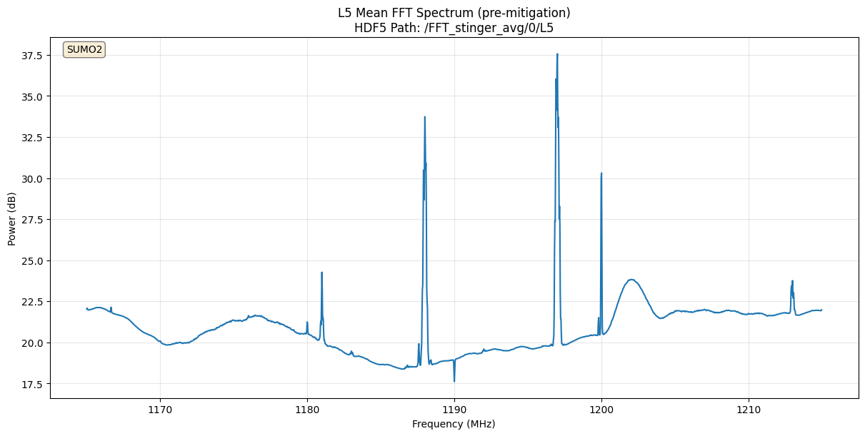
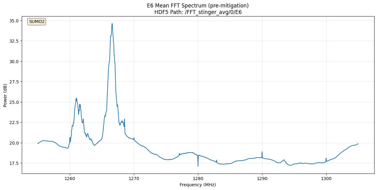
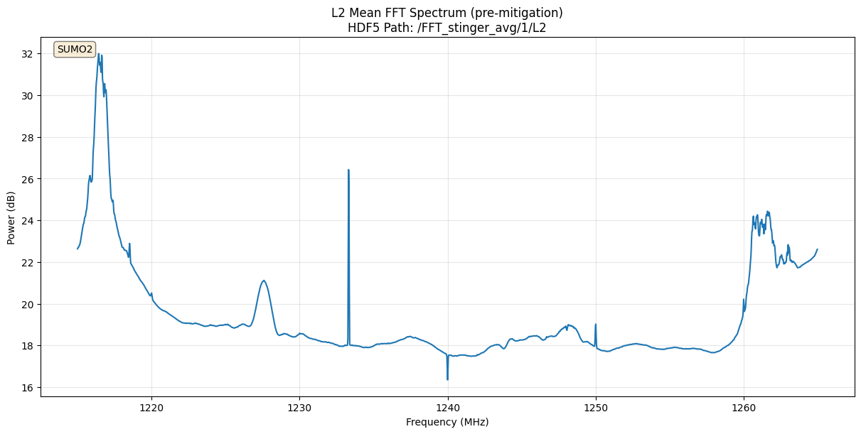
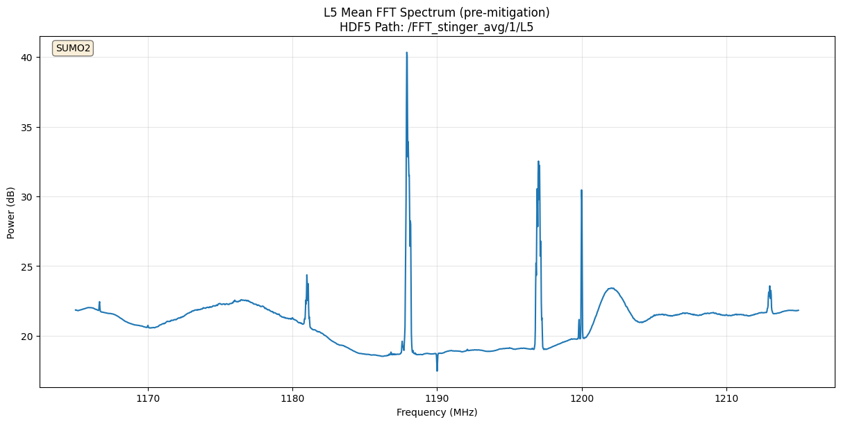
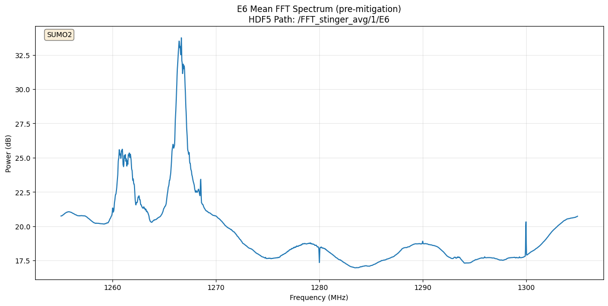
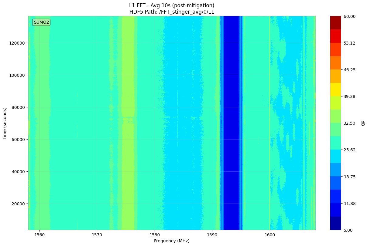
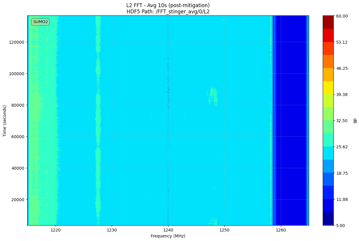
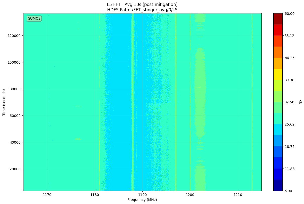
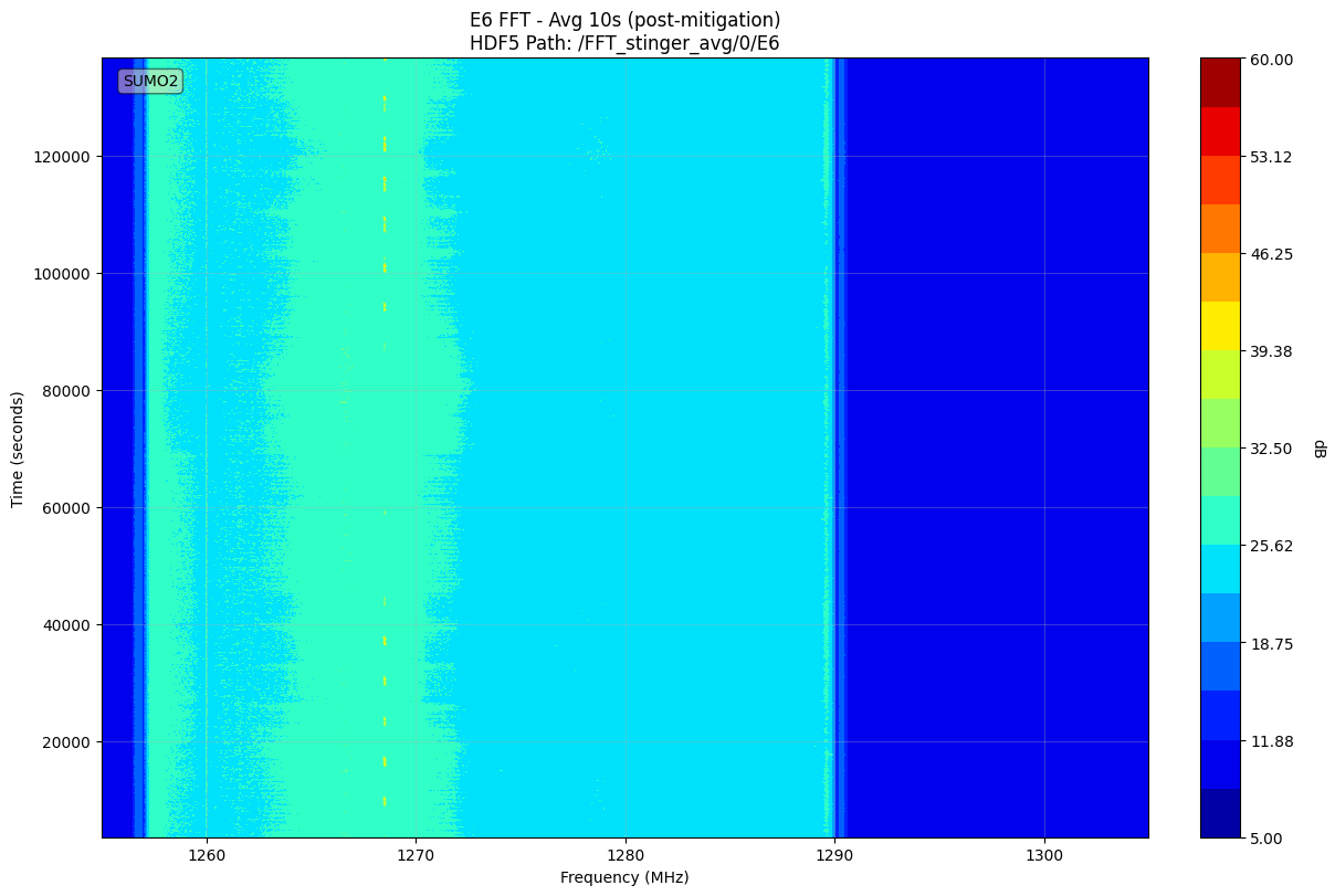
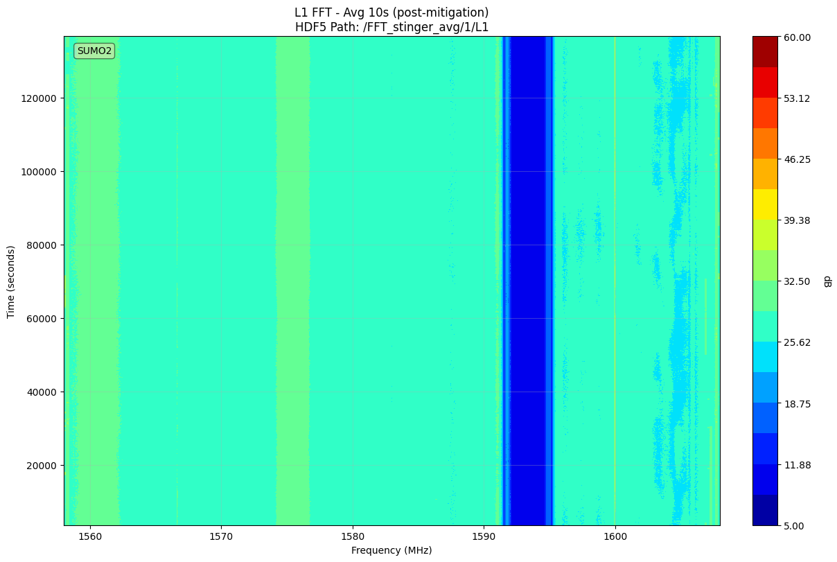
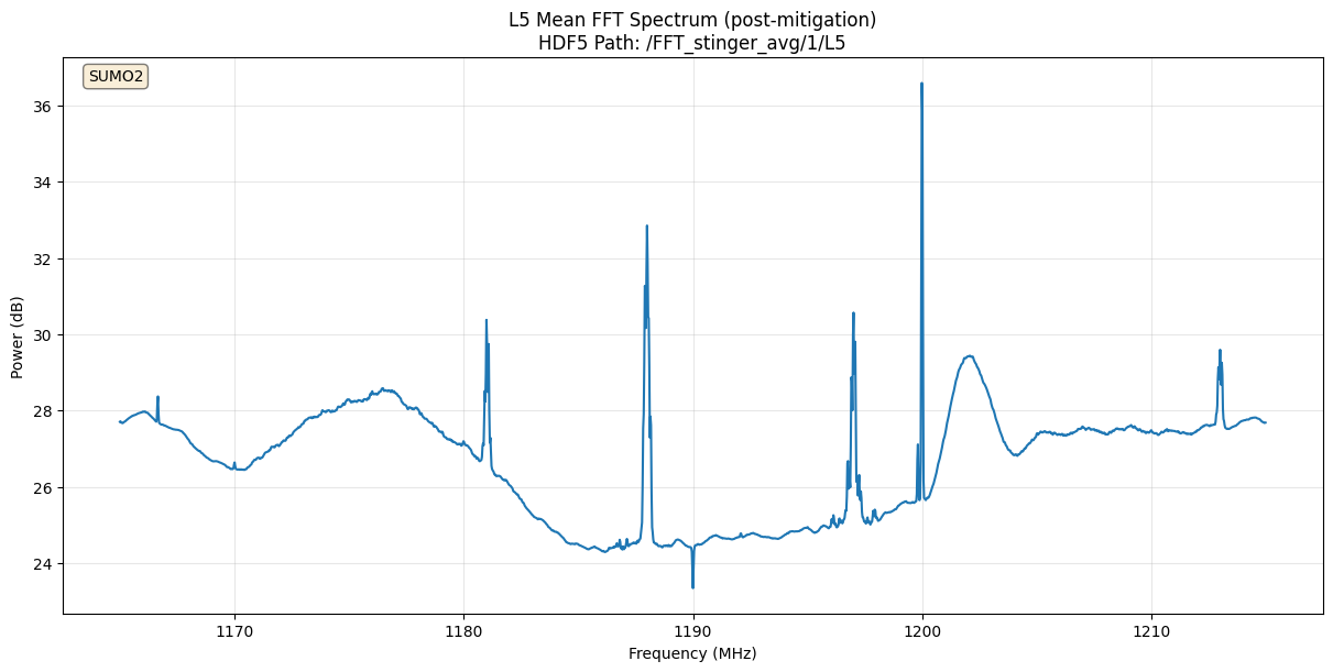
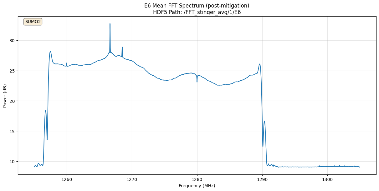
| Antenna | L1 | L2 | L5 | E6 | B1 | S1 | G1 |
|---|---|---|---|---|---|---|---|
| Ant 0 |

|
|
|
|
- | - | - |
| Ant 1 |

|
|

|
|
- | - | - |
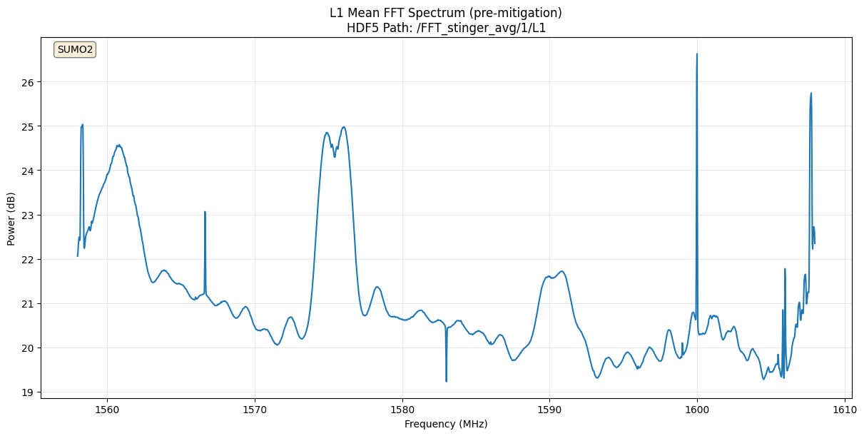
| Antenna | L1 | L2 | L5 | E6 | B1 | S1 | G1 |
|---|---|---|---|---|---|---|---|
| Ant 0 |
|
|
|
|
- | - | - |
| Ant 1 |
|
|
|
|
- | - | - |
| Antenna | L1 | L2 | L5 | E6 | B1 | S1 | G1 |
|---|---|---|---|---|---|---|---|
| Ant 0 |
|
|
|
|
- | - | - |
| Ant 1 |
|
|
|
|
- | - | - |
| Antenna | L1 | L2 | L5 | E6 | B1 | S1 | G1 |
|---|---|---|---|---|---|---|---|
| Ant 0 |
|

|
|
|
- | - | - |
| Ant 1 |
|
|
|
|
- | - | - |